Revolutionizing Landslide Predictions: A Game-Changing Discover from California's Geology!
2024-10-29
Author: Sarah
Introduction
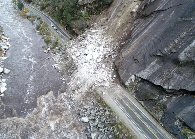
Landslides have long haunted California, a state characterized by its unique geology and steep landscapes that make it susceptible to this perilous phenomenon. Fortunately, a team of researchers from the University of Texas Institute for Geophysics and UC Santa Cruz may have cracked the code to predicting landslide behavior by studying the very rocks where these disasters occur. Their groundbreaking findings, published on October 16, 2024, in the esteemed journal Science Advances, leverage principles from earthquake science to illuminate the mechanics of landslides.
Understanding the Connection Between Earthquakes and Landslides
In California, earthquakes and landslides share common geological features, and the researchers assert that understanding one can significantly enhance predictions for the other. This means that by applying earthquake physics to landslide dynamics, they can offer crucial insight into how and when a surface might become unsteady during periods of heavy rainfall.
The Role of Rock Type in Landslide Behavior
The researchers pinpointed the type of rock involved as a key factor in landslide behavior. In the California Coast Ranges—a complex assembly of varied rock types shaped by eons of tectonic activity—clay-like and soft rocks allow for gradual movement, shifting inches over weeks. In contrast, harder rocks build up strain, resulting in sudden and catastrophic landslides when they finally give way.
Historical Context and the Need for Prediction
Historically, California has faced frequent and destructive landslides. Just last September, a significant slide in Rancho Palos Verdes forced hundreds of residents to evacuate as it gradually collapsed parts of the city after heavy, historic storms earlier in the year. The new predictive model presented by these researchers could provide communities vital information about the timing and risk of future landslides in relation to rainfall and similar environmental changes.
A New Framework for Understanding Ground Movement
This study gives us a framework to anticipate ground movement based on shifts in rainfall and subsequent water pressure changes, stated Noah Finnegan, lead author of the study and professor of earth and planetary sciences at UC Santa Cruz.
Innovative Research Methodology
The innovative approach taken by the researchers was akin to conducting a practical laboratory experiment. By combining extensive data from two notable Northern California landslides—tracking environmental conditions and land movement—they were able to derive the characteristics of the rocks responsible for each landslide. They even successfully applied this model to a landslide dating back to the early 1980s, solidifying the robustness of their findings.
Developing Landslide Hazard Maps
Saffer suggested that developing an effective landslide hazard map can be simplified by analyzing the geology of specific areas. By conducting targeted rheology measurements of rocks in lab settings and coupling that with geological mapping, we could predict how these areas would respond to both rainfall and earthquake-induced shaking, he explained. This could help in identifying high-risk zones for rapid landslides compared to those with slower movements.
Future Directions and Broader Applications
Looking ahead, Saffer and Finnegan aim to refine their predictive model in other geographic regions, broadening its applicability to various rock types. With the backing of the National Science Foundation, this research promises to be a pivotal step in understanding landslides and safeguarding communities against this age-old threat.
Conclusion
This new model not only enhances our understanding of geological behaviors but could also prove crucial for emergency preparedness and disaster risk mitigation as communities continue to grapple with the impacts of climate change and extreme weather events. Stay tuned for more updates on this transformative research!


 Brasil (PT)
 Canada (EN)
 Chile (ES)
 España (ES)
 France (FR)
 Hong Kong (EN)
 Italia (IT)
 日本 (JA)
 Magyarország (HU)
 Norge (NO)
 Polska (PL)
 Schweiz (DE)
 Singapore (EN)
 Sverige (SV)
 Suomi (FI)
 Türkiye (TR)