Groundbreaking Discovery: Ship-Based Satellite Data Tracks a Landslide Tsunami for the First Time!
2025-05-14
Author: Siti
Imagine a massive landslide crashing into the ocean and sending tsunami waves barreling toward unsuspecting coastal towns! Landslide-generated tsunamis are a hidden threat, especially in narrow fjords where towering cliffs can intensify the waves. Traditional tsunami warning systems focus largely on earthquake activity, often overlooking the localized movements caused by landslides—until now.
In a scientific milestone, researchers have successfully detected tsunami waves triggered by a landslide using a ship's satellite receiver. This groundbreaking study led by the Cooperative Institute for Research in Environmental Sciences (CIRES) and the University of Colorado Boulder, recently published in Geophysical Research Letters, paves the way for revolutionary improvements in tsunami detection methods.
The Moment That Changed Everything
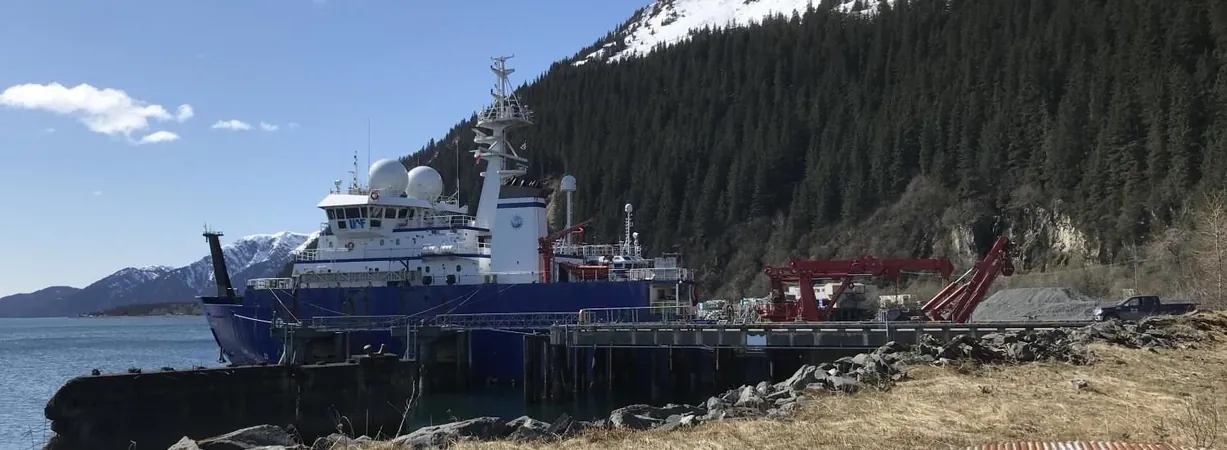
On May 8, 2022, a dramatic landslide near Seward, Alaska, sent debris tumbling into Resurrection Bay, unleashing a series of small tsunami waves. Fortunately, the R/V Sikuliaq, a National Science Foundation research vessel and the star of this study, was anchored just 650 meters away, equipped with a cutting-edge Global Navigation Satellite System (GNSS) receiver.
"I happened to be in Alaska at the time, gathering seismometers from another project," recalled CIRES Fellow Anne Sheehan, co-author of the study. "When I visited the Sikuliaq, I learned about the recent landslide. One crew member had even filmed it! We knew we had a valuable signal to hunt for in the data."
Unlocking Tsunami Secrets with Satellite Technology
With graduate student Adam Manaster at the helm, the research team utilized the Sikuliaq's GNSS data combined with open-source software to detect minute changes in the vessel's vertical position. They created a detailed timeline of the ship's movement before, during, and after the landslide.
The researchers then matched their findings against a landslide-tsunami model to simulate how the tsunami waves formed and traveled from the shoreline to the ship. Their results confirmed that the ship's movements aligned perfectly with the event, marking the first successful detection of a landslide tsunami through a ship's satellite navigation system.
A Game-Changer for Tsunami Warnings
"This research proves that ships can play a pivotal role in tracking the timing and magnitude of landslide-generated tsunamis," said Manaster. "If we can analyze the data quickly enough, timely warnings can be sent out to communities at risk, helping them evacuate and avoid disaster!"
This significant advance builds on previous CIRES research demonstrating how GPS data from commercial shipping vessels can enhance tsunami early warning systems, pushing the boundaries of how technology can safeguard coastal populations from nature's unexpected fury.


 Brasil (PT)
 Canada (EN)
 Chile (ES)
 Česko (CS)
 대한민국 (KO)
 España (ES)
 France (FR)
 Hong Kong (EN)
 Italia (IT)
 日本 (JA)
 Magyarország (HU)
 Norge (NO)
 Polska (PL)
 Schweiz (DE)
 Singapore (EN)
 Sverige (SV)
 Suomi (FI)
 Türkiye (TR)
 الإمارات العربية المتحدة (AR)