Revolutionizing Hurricane Forecasting: How NASA's Sentinel-6B Satellite Will Change the Game
2025-08-04
Author: Emily
A New Era in Hurricane Predictions
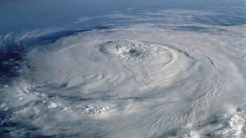
NASA is set to enhance its long-standing mission of monitoring Earth’s sea level—a crucial factor not only in understanding oceanic changes but also in refining hurricane forecasts. With hurricanes costing the U.S. billions and causing widespread chaos, the launch of the Sentinel-6B satellite, in November 2025, promises to bring breakthroughs in predicting these storms.
The Sentinel-6: A Game-Changing Partnership
The Sentinel-6B, part of a collaborative mission between NASA and the European Space Agency, will join its twin, Sentinel-6 Michael Freilich, which has been gathering vital sea-level data since its launch in 2020. These satellites represent decades of collaborative effort to monitor our oceans and their changes.
"With Sentinel-6, we’ll be able to monitor ocean height, heat, and movement on a global scale, improving predictions for local disasters like hurricanes," explained Nadya Vinogradova Shiffer, a program scientist at NASA.
How Sea Level Affects Hurricane Intensity
Understanding sea surface height is key to forecasting hurricane intensity. Warmer water acts as fuel for hurricanes. Scientists have determined that regions with deeper layers of warm water can escalate a storm's power significantly. Josh Willis, project scientist for Sentinel-6B, notes that deeper warm waters can lead to stronger hurricanes.
Unlocking the Secrets of Rapid Intensification
Forecasters utilize sea level data in two critical ways: first, to set accurate oceanic conditions in forecasting models, and second, to enhance machine learning models predicting rapid intensification of storms. Using data from satellites like Sentinel-6, meteorologists can forecast when a hurricane will dramatically intensify, such as when wind speeds swiftly escalate by 35 mph within 24 hours.
The Case of Hurricane Milton
A recent example of this capability was Hurricane Milton, which transformed from a Category 1 to a Category 5 storm in just 24 hours, fueled by an underlying deep reservoir of warm water—insights that were gleaned from the data provided by Sentinel-6 Michael Freilich.
Improving Forecasts Since 1992
Since the inception of the sea level satellite program in 1992, meaningful advancements in hurricane forecasting have been realized. Although initial forecasts were often inaccurate, advances in technology and data collection have been pivotal. A federal initiative launched in 2007 further propelled these advancements from research into effective operational use.
The Economic Impact of Accurate Forecasts
According to economist Renato Molina, improving the reliability of hurricane forecasts can save communities billions of dollars. Timely predictions enable residents to prepare adequately, either by securing property or evacuating in advance.
A Critical Partnership Between Sensors and Satellites
As hurricane forecasts grow more sophisticated, integrating sea-level data from these advanced satellites becomes increasingly vital. Mark DeMaria emphasizes that we cannot rely solely on one data source; ocean sensors and satellite data must work hand-in-hand to provide the best insights for future hurricane forecasts.


 Brasil (PT)
 Canada (EN)
 Chile (ES)
 Česko (CS)
 대한민국 (KO)
 España (ES)
 France (FR)
 Hong Kong (EN)
 Italia (IT)
 日本 (JA)
 Magyarország (HU)
 Norge (NO)
 Polska (PL)
 Schweiz (DE)
 Singapore (EN)
 Sverige (SV)
 Suomi (FI)
 Türkiye (TR)
 الإمارات العربية المتحدة (AR)