What is a Sumatra Squall and How It Recently Impacted Singapore
2024-09-18
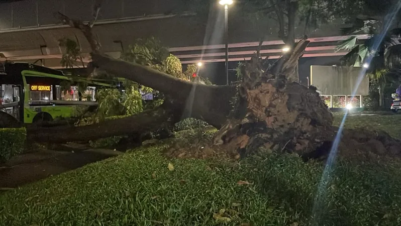
SINGAPORE: On the night of September 17, Singapore faced a sudden and fierce storm characterized by strong winds and torrential rain, leading to the uprooting of trees across the island. Meteorological experts have suggested that this intense weather event was likely the result of a Sumatra squall.
Understanding the Sumatra Squall
So, what exactly is a Sumatra squall? In simple terms, a squall represents a sudden, short-lived burst of strong winds accompanied by heavy rainfall. Particularly in our region, a Sumatra squall refers to a line of thunderstorms that originates over Indonesia’s Sumatra Island or the Strait of Malacca. These squalls often drift eastward, bringing rapid and severe weather conditions to Singapore and the Malaysian Peninsula.
Typically, a squall can deliver thundery showers lasting from one to two hours, with wind gusts sometimes peaking at an astonishing 80 km/h. The unique linear structure of these squalls allows them to affect a broader area compared to ordinary storms; however, the intensity usually subsides as quickly as it arises.
As Professor Matthias Roth of the National University of Singapore explains, 'Squall lines are mesoscale weather systems that can stretch for hundreds of kilometers but are only a few tens of kilometers wide, which allows them to rapidly pass through affected regions.' The development of these squalls is often linked to the cooling of air over the elevated terrain of northern Sumatra.
When Do These Squalls Occur?
Sumatra squalls generally occur during the southwest monsoon and inter-monsoon periods, which span from April to November each year. This weather pattern is closely tied to prevailing winds from the southwest. According to Dr. Wang Jingyu, an expert in physical geography at the National Institute of Education, the winds are forced to rise over the Bukit Barisan mountain range, generating linear convection systems that then travel across the Malacca Strait towards Malaysia.
Additionally, the recent squall over Singapore may have been exacerbated by Typhoon Bebinca, which acted as a 'pump' to bolster the southwesterly winds, leading to the swift development and movement of the squall, as explained by Dr. Wang.
Rare Conditions for a Squall
Dr. Dhrubajyoti Samanta, a senior research fellow at the Earth Observatory of Singapore, highlighted that this particular squall was exceptional because such weather events typically occur during the pre-dawn or early morning hours, not in the evening. Satellite imagery indicated that there were powerful convective clouds spanning from the eastern Indian Ocean to the Philippines, which could have influenced the storm’s duration and intensity.
Furthermore, a low-pressure system located in the western Pacific Ocean may have played a role in directing cloud bands and winds toward Singapore in a northeastward motion. This unusual interaction of weather systems contributes to the growing unpredictability of storms in the region.
As global climate changes continue to influence weather patterns, experts warn that residents should remain vigilant and well-prepared for such intense weather phenomena, seeking out timely forecasts and taking necessary precautions.


 Brasil (PT)
 Canada (EN)
 Chile (ES)
 España (ES)
 France (FR)
 Hong Kong (EN)
 Italia (IT)
 日本 (JA)
 Magyarország (HU)
 Norge (NO)
 Polska (PL)
 Schweiz (DE)
 Singapore (EN)
 Sverige (SV)
 Suomi (FI)
 Türkiye (TR)