Unveiling Antarctica's Hidden Waterfalls: How Satellites Are Transforming Climate Studies
2025-04-22
Author: Wei Ling
Discovering Underwater Waterfalls Beneath Antarctic Waves
Beneath the icy surface of the Southern Ocean lies a breathtaking phenomenon: massive volumes of cold, dense water cascading down underwater cliffs, creating what can only be described as hidden waterfalls. These sub-sea cascades are crucial components of the global ocean's overturning circulation, serving as a conveyor belt that transports heat, carbon, and nutrients around our planet—an essential mechanism for regulating Earth's climate.
The Challenge of Researching Remote Waters
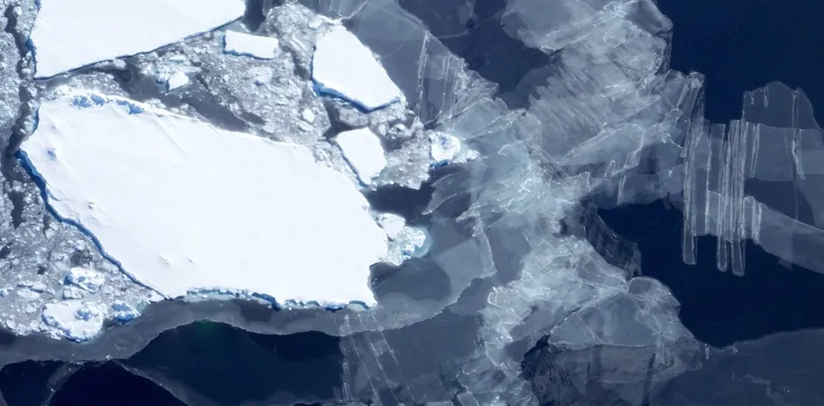
For years, scientists faced significant challenges in observing these underwater waterfalls, predominantly due to their location in the remote, stormy waters of Antarctica. Often concealed by thick sea ice and funneled through narrow canyons, these sites are easily overlooked by research vessels.
A Revolutionary Satellite Discovery
However, groundbreaking research reveals that satellites, orbiting hundreds of kilometers above us, can now detect these submerged waterfalls. By measuring minuscule dips in sea level—just a few centimeters—scientists have developed the ability to track these dense water cascades from space, providing vital data on the ocean's deeper circulation branches, which are currently experiencing a slowdown due to warming surface waters and melting Antarctic ice.
The Role of Dense Water in Climate Regulation
Antarctic dense water is generated when sea ice expands, increasing the salinity and density of surrounding water. This heavier water flows across the continental shelf and spills over steep underwater slopes, plunging into the depths below. As it travels northward along the seafloor, it transports essential oxygen, nutrients, carbon, and heat from the atmosphere into the abyss.
Climate Change: A Dire Threat
Yet, this vital mechanism is under siege. Climate change is rapidly melting the Antarctic ice sheet, introducing fresh water into the ocean and hindering the formation of dense water. Previous studies indicate a staggering 30% slowdown in abyssal circulation, with projections suggesting further deterioration, potentially diminishing the ocean's capacity to absorb heat and carbon, exacerbating climate change.
A New Era in Satellite Monitoring
Our innovative research introduces a new monitoring technique that can directly observe shifts in the Southern Ocean's overturning circulation efficiently and cost-effectively. Historically, tracking these dense water cascades relied heavily on moorings, ship surveys, and sensors attached to seals—methods that are expensive, logistically challenging, and only encompass limited areas.
In contrast, satellites like CryoSat-2 and Sentinel-3A utilize radar technology to measure sea surface height changes with remarkable precision. Recent advancements in data processing now enable reliable measurements even in ice-covered zones, allowing scientists to peer through cracks in the ice.
Measuring Environmental Change from Above
By amalgamating nearly a decade of satellite data with high-resolution ocean models specifically focused on the Ross Sea—a significant site for dense water formation—we identified a consistent dip in sea level, a telltale indicator of cold, heavy water descending below.
This method marks the first time Antarctic dense water cascades have been monitored from space, providing long-term, extensive observations without any carbon emissions and at minimal cost, using existing satellite technology.
Monitoring Our Changing Climate
As our climate continues to shift at an unprecedented pace, the ability to monitor these deep Antarctic currents presents a powerful tool for understanding our changing environment. By improving our insights into these dynamics, researchers can develop more effective strategies for climate adaptation.


 Brasil (PT)
 Canada (EN)
 Chile (ES)
 Česko (CS)
 대한민국 (KO)
 España (ES)
 France (FR)
 Hong Kong (EN)
 Italia (IT)
 日本 (JA)
 Magyarország (HU)
 Norge (NO)
 Polska (PL)
 Schweiz (DE)
 Singapore (EN)
 Sverige (SV)
 Suomi (FI)
 Türkiye (TR)
 الإمارات العربية المتحدة (AR)