Sentinel-2C Satellite Unveils Stunning Earth Imagery in Historic First Month
2024-09-23
In just under two weeks since its launch, the Sentinel-2C satellite has mesmerized the world with its first breathtaking images of Earth, demonstrating its vital role within Copernicus, Europe's esteemed Earth observation program.
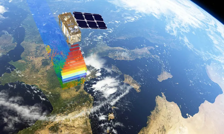
Launched on September 5 from French Guiana on the last Vega rocket, Sentinel-2C joins its predecessors, Sentinel-2A and Sentinel-2B, in the quest to closely monitor our planet’s environment. The satellite is outfitted with a state-of-the-art multispectral camera capable of capturing high-resolution images from an altitude of 786 kilometers (about 488 miles). This advanced optical instrument spans an impressive swath width of 290 kilometers, capturing images across 13 distinct spectral bands at resolutions of 10 m, 20 m, and 60 m.
These capabilities enable Sentinel-2C to survey vast portions of the Earth with remarkable precision, offering critical data for a myriad of applications, including environmental monitoring and disaster management. Within just a week of its launch, the satellite successfully acquired stunning images from various global locations, showcasing its versatility in Earth observation.
Among the initial images are vibrant scenes including a detailed view of Seville and its surrounding areas in southern Spain. Another striking image captures a stretch from Camargue and Montpellier in southern France all the way down to Barcelona in Spain. However, the satellite's reach extends well beyond Europe. One of the most impactful early captures reveals the catastrophic wildfires south of Los Angeles, California. By utilizing different spectral bands, the images provide a stark contrast between natural colors and the vivid orange spots indicating areas of active burning.
But Sentinel-2C's talents don’t end with disaster response. The satellite has also documented the tranquil beauty of the Lighthouse Reef, part of the stunning coral reef system off Belize's coast. In these vivid images, the famed Great Blue Hole, a large marine sinkhole, is prominently displayed, highlighting the valuable contributions of Sentinel-2C to marine and coastal observation.
“These initial images are a powerful testament to the success of this significant mission,” commented Simonetta Cheli, Director of Earth Observation Programmes at the European Space Agency (ESA). “While Sentinel-2 will serve Copernicus for years to come, we are already preparing for the next chapter with the upcoming Sentinel-2 Next Generation mission.
Following its productive launch, Sentinel-2C is currently undergoing calibration, a process expected to last around three months. The satellite’s early performance has already surpassed expectations, with its commissioning activities proceeding alongside the routine operations of other Sentinel satellites.
Data generated by the Sentinel-2 series, including the newly operational Sentinel-2C, is crucial for various applications such as agriculture, water quality monitoring, and addressing natural disasters like wildfires and floods. Users can access this valuable data freely through the Copernicus Data Space Ecosystem.
As the Sentinel-2C project manager, Constantin Mavrocordatos stated, "We are thrilled to see the Copernicus Sentinel-2C already capturing such stunning images so soon after its launch. This is just the beginning of the extensive insights and detailed data it will provide for better understanding our planet."
With satellites like Sentinel-2C, we aren't merely observing the Earth; we are piecing together a comprehensive picture of our world, contributing significantly to environmental conservation efforts and enhancing disaster preparedness.
Stay tuned as we continue to witness the remarkable journey of Sentinel-2C and its contributions to understanding Earth's changing landscape—one breathtaking image at a time!


 Brasil (PT)
 Canada (EN)
 Chile (ES)
 España (ES)
 France (FR)
 Hong Kong (EN)
 Italia (IT)
 日本 (JA)
 Magyarország (HU)
 Norge (NO)
 Polska (PL)
 Schweiz (DE)
 Singapore (EN)
 Sverige (SV)
 Suomi (FI)
 Türkiye (TR)