Satellite Innovations Pave Way for Future Wildfire Prevention
2025-01-18
Author: Wei Ling
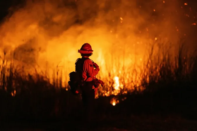
As Los Angeles grapples with the aftermath of devastating wildfires, experts are optimistic that advancements in satellite technology can make a significant impact in combating future blazes. This optimism comes as more tech-driven organizations embark on ambitious satellite projects, harnessing the power of affordable space launches and cutting-edge machine learning techniques to analyze vast amounts of data related to fire risks.
According to Clement Albergel, head of actionable climate information at the European Space Agency (ESA), satellites are capable of monitoring dry regions prone to wildfires, detecting active flames, smoldering embers, as well as assessing burnt areas and smoke emissions. This comprehensive data can help inform strategies for wildfire prevention and mitigation.
Satellites serve various purposes depending on their orbital positions and equipment. Low Earth orbit (LEO) satellites, located less than 1,000 kilometers (620 miles) above the planet, provide high-resolution images of the ground but only capture brief snapshots of specific locations. In contrast, geostationary satellites maintain a fixed position approximately 36,000 kilometers above Earth, allowing for continuous monitoring, albeit at lower resolution.
As climate change continues to exacerbate the frequency and severity of wildfires threatening populated areas, precise and timely satellite imagery becomes increasingly essential. Natasha Stavros, a wildfire expert with experience at NASA, emphasizes the difficulty in determining the exact location of fires, which can leave residents unprepared and at risk. "Many people may not fully comprehend the severity of the situation," she explains, underscoring the need for enhanced satellite observations.
To tackle this challenge, Brian Collins, director of the nonprofit organization Earth Fire Alliance, is spearheading the launch of a new constellation of low-orbit satellites aimed at augmenting existing monitoring technologies. These advanced satellites will utilize sensors with a resolution of just five meters (16 feet), significantly sharper than the current ESA Sentinel-2 satellites, which can only detect objects that are 10 meters wide. This upgraded capability will likely reveal a hidden landscape of small fires that are currently undetected, promising to reshape our understanding of wildfire occurrences.
The Earth Fire Alliance plans to launch four satellites by the end of 2026, with the first one expected in a matter of weeks. The project's budget of $53 million, described by Genevieve Biggs from the Gordon and Betty Moore Foundation as a "drop in the bucket," contrasts sharply with the extensive damage and loss of life caused by wildfires each year. Ultimately, Collins envisions deploying a total of 55 satellites—costing around $400 million—to achieve his goal of imaging every spot on Earth at least once every 20 minutes.
Meanwhile, German startup OroraTech recently launched the first of at least 14 compact FOREST-3 “nanosatellites” designed to issue rapid wildfire alerts with high-quality thermal data. Chief executive Martin Langer states that these satellites would significantly enhance real-time monitoring capabilities.
As the buzz around these innovations grows, experts frequently remind us that while the influx of satellite data is promising, it also poses unique challenges. For example, the ESA's Sentinel-2 transmits a staggering one terabyte of data daily—the equivalent storage of an advanced personal laptop. Sifting through such a massive influx of information to identify early signs of wildfires is akin to finding a "needle in a haystack," as Collins describes, but machine learning and artificial intelligence may prove vital in overcoming this hurdle.
Looking ahead, Stavros cautions that there is no singular technological fix for wildfire management. It will require an integrated approach, harmonizing diverse technologies to assist emergency responders and help mitigate fire risks. In addition to deploying high-tech monitoring systems, efforts by organizations like the Moore Foundation are also focused on building community resilience and enhancing fire-prone ecosystems, promoting beneficial ecological burns while reducing the threat of destructive ones.
As the wildfire season intensifies and more data becomes available, the collaborative potential of these satellite projects could revolutionize how we monitor, understand, and ultimately prevent wildfires, ensuring greater safety for those living in these vulnerable regions.


 Brasil (PT)
 Canada (EN)
 Chile (ES)
 Česko (CS)
 대한민국 (KO)
 España (ES)
 France (FR)
 Hong Kong (EN)
 Italia (IT)
 日本 (JA)
 Magyarország (HU)
 Norge (NO)
 Polska (PL)
 Schweiz (DE)
 Singapore (EN)
 Sverige (SV)
 Suomi (FI)
 Türkiye (TR)
 الإمارات العربية المتحدة (AR)