Revolutionizing Deep Space Navigation: How GEO Satellites Offer Better Tracking of Probes
2025-07-30
Author: John Tan
Exploring the Vastness: The Balance of Challenges and Advantages
In the realm of astronomy, the immense distances of space come with both challenges and opportunities. Communication times lengthen, necessitating powerful equipment, and positioning uncertainties can interfere with vital measurements, especially in the solar system's distant reaches. However, these same distances can enhance a technique known as interferometry, which allows precise location assessments by leveraging data from systems far apart—similar to how GPS operates.
Introducing RINGS: The Groundbreaking Navigation Concept
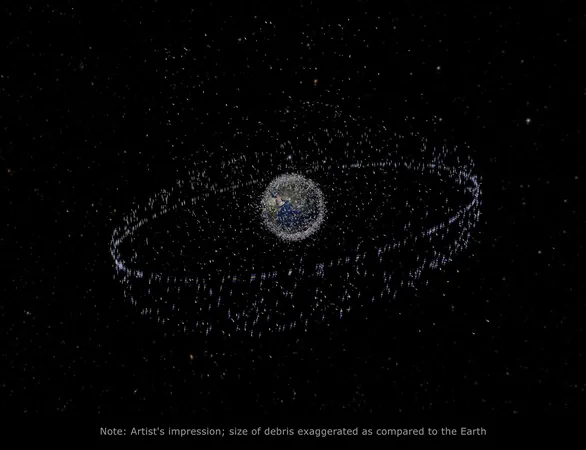
A groundbreaking new paper presents a strategy to track deep space probes using geostationary satellites, termed the Radiometric Interferometry for Deep Space Navigation using Geostationary Satellites (RINGS). This innovative method seeks to replace traditional Very Long Baseline Interferometers (VLBIs) on Earth, utilizing satellites in geostationary orbit to deliver consistent location data to probes across our solar system.
Enhanced Accuracy and Uptime: The RINGS Advantage
One of RINGS' standout features is its significant distance advantage; the satellites operate 80,000 km apart, vastly outperforming the 8,000 km separation between earthly VLBIs. Greater distance enhances accuracy—a principle that networks like GPS rely on. Furthermore, RINGS boasts a remarkable uptime of 98%, ensuring reliable data availability compared to the Earth's VLBIs that offer just 49.7% availability due to planetary rotation.
Navigating the Challenges of Space
Despite its advantages, RINGS faces unique challenges. A key issue is the Doppler shift caused by the relative motion of the satellites, complicating phase measurements critical for accurate location calculations. Moreover, while Earth-based VLBI systems can utilize stable hydrogen maser clocks, geostationary satellites typically depend on Rubidium clocks, which, while adequate, exhibit drift that can add up over extended periods.
Accuracy in Positioning: The Quest for Precision
Another hurdle for RINGS is the positioning of the geostationary satellites. Unlike the well-mapped VLBI stations on Earth, GEO satellites have a positioning accuracy only within 10 to 100 meters. As distances in space grow to astronomical units (AU), even minor uncertainties can compound significantly. To address this, authors from Technion in Haifa propose enhancements that could improve spatial accuracy to within 0.5 meters.
The Future of Deep Space Navigation
Assuming these advancements materialize, the RINGS system could achieve accuracy levels comparable to those of terrestrial VLBI systems, albeit slightly less precise. However, its impressive availability at 98% might just tip the scales in favor of investing in a network of GEO satellites for deep space tracking. The potential for revolutionizing how we navigate the vastness of our solar system is clear, but only time will tell whether this compelling proposition will come to fruition.


 Brasil (PT)
 Canada (EN)
 Chile (ES)
 Česko (CS)
 대한민국 (KO)
 España (ES)
 France (FR)
 Hong Kong (EN)
 Italia (IT)
 日本 (JA)
 Magyarország (HU)
 Norge (NO)
 Polska (PL)
 Schweiz (DE)
 Singapore (EN)
 Sverige (SV)
 Suomi (FI)
 Türkiye (TR)
 الإمارات العربية المتحدة (AR)