Revolutionary Satellite Technology Set to Save Lives in the Solway Firth
2024-11-15
Author: Ming
Introduction
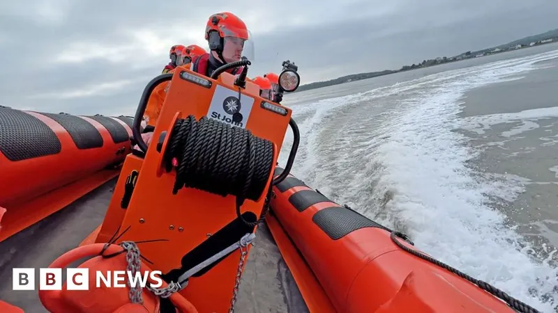
In an innovative effort to enhance maritime safety, a groundbreaking project aims to leverage satellite data to aid lifeboats in navigating the treacherous waters of the Solway Firth. This undertaking comes as the region, located off the southern coast of Scotland, is regarded as one of the most perilous due to its rapid tidal movements, which are among the fastest in Europe.
The Safe Passage Project
The coastline features extensive mudflats surrounding the estuaries of the River Nith and River Annan, where residents and visitors alike face risks from shifting sands, including potentially dangerous quicksand.
Enter the Safe Passage project, a pilot initiative inspired by Nith Inshore Rescue, which saw the University of Strathclyde integrating advanced satellite imagery technology into rescue operations. By harnessing synthetic aperture radar (SAR) data from satellites, researchers are creating accurate, real-time maps of the region's ever-changing navigational channels, which can fluctuate dramatically due to tidal shifts.
Challenges in Traditional Navigation
Traditional marine navigation maps often leave critical areas uncharted, posing risks not just to those in distress but also to the lifeboat crews attempting to reach them. Under current conditions, rescuers had to rely on manual depth soundings, which could quickly become outdated and inaccurate during bad weather or swift tidal movements, forcing lifeboats to alter their courses mid-rescue—slowing response times and risking grounding.
Professor Malcolm Macdonald, who leads the applied space technology team at the University of Strathclyde, emphasized the urgency of this project. "The new approach enables consistent mapping of the intertidal zone, allowing rescue teams to reach those in need swiftly and safely," he stated. "Given the rapid changes in this environment, the ability to receive updated charts could prove life-saving."
Advantages of SAR Technology
SAR technology stands out due to its ability to penetrate cloud cover—a common issue in Scotland—whereas typical optical satellite imagery struggles to provide clear images. This unique capability allows rescue teams to distinguish between sand and water, ensuring a safer passage through previously uncharted waters, even at night.
Impact and Real-Life Applications
The impact of this initiative is already being felt. The updated satellite-generated waypoints have already been utilized in real-life situations, including a successful rescue operation along the Cumbrian coast for individuals trapped in a car due to severe coastal flooding.
Ongoing Challenges and Considerations
Yet challenges remain. As climate change continues to influence tidal patterns, the volunteers from Nith Inshore Rescue stress the importance of combining satellite information with their own local knowledge to navigate the ever-evolving landscape effectively.
Future Aspirations
The collaboration with the European Space Agency (ESA) not only seeks to refine charting methods but also aspires to make the 13 million hectares of global tidal flats more navigable. With lives on the line, this fusion of technology and local expertise promises a brighter—and safer—future for maritime rescue operations in the Solway Firth and beyond.
Conclusion
Stay tuned as this story evolves! What further innovations lie ahead in the realm of life-saving technology?


 Brasil (PT)
 Canada (EN)
 Chile (ES)
 España (ES)
 France (FR)
 Hong Kong (EN)
 Italia (IT)
 日本 (JA)
 Magyarország (HU)
 Norge (NO)
 Polska (PL)
 Schweiz (DE)
 Singapore (EN)
 Sverige (SV)
 Suomi (FI)
 Türkiye (TR)