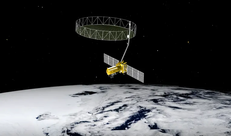
Revolutionary NISAR Satellite Set to Transform Our Understanding of Earth's Changes
2025-01-12
Author: John Tan
NISAR: The Next Frontier in Earth Observation
Scheduled for launch in the coming months, NISAR represents a significant leap forward in satellite technology, merging advanced radar capabilities with a mission dedicated to tracking the myriad changes occurring on Earth’s surface. Utilizing a groundbreaking dual-band radar system, NISAR combines both L-band and S-band radar technologies. The L-band, with its 25-centimeter wavelength, is adept at penetrating vegetation, allowing it to reveal larger features like forests and rocky terrains. Meanwhile, the S-band radar operates at a shorter wavelength of 10 centimeters, making it more sensitive to finer surface details like leaves and soil textures. The synergy of these two radar systems is unprecedented, vastly enhancing our ability to monitor and study diverse terrestrial features with superior accuracy.
How NISAR Will Impact Our Understanding of Earth
NISAR is engineered to comprehensively observe nearly all terrestrial and ice surfaces. Its capabilities will allow scientists to monitor glaciers for movement patterns related to climate change, assess forests’ health by tracking growth and decline, and evaluate crucial wetland ecosystems. This mission spans beyond effortless monitoring; it also encompasses the tracking of natural disasters such as earthquakes and volcanic eruptions. The data collected will play a pivotal role in emergency response, aiding in damage assessment and resource allocation. Furthermore, by gathering data on Earth’s fluid dynamics, NISAR will contribute valuable information to the global carbon cycle, a critical aspect of understanding climate change and its far-reaching impacts.
Building on a Legacy of Innovation
The NISAR mission is rooted in the history of radar technology. The initial concept can be traced back to the 1970s with NASA’s Seasat mission, which, although it only operated for a few months, laid the groundwork for future Earth observation satellites. Seasat galvanized the development of sophisticated radar imaging techniques that ultimately inform the capabilities seen in today's missions, such as NISAR.
The Significance of International Cooperation
NISAR is more than just a technological feat; it symbolizes international collaboration at its finest. Since 2014, NASA and India’s ISRO have joined forces, blending their diverse expertise to create a satellite that leverages both organizations' strengths. Developing components across continents presented complex logistical challenges, including coordinating operations across multiple time zones and assembling parts in India. Nevertheless, this partnership signifies a commitment to collective action against global challenges such as climate change and natural disaster preparedness.
Addressing Global Challenges Together
NISAR’s impact reaches beyond scientific discovery; it embodies a concerted effort to address urgent global issues by providing extensive datasets that will be made publicly available via cloud storage. This data will facilitate research addressing crucial environmental questions, from soil moisture monitoring to the assessment of cryospheric processes. As the countdown to its launch begins, the NISAR satellite stands ready to unveil groundbreaking insights about our ever-evolving planet, encouraging a better understanding of both natural phenomena and the challenges posed by climate change. With its promise of innovation and international unity, NISAR is set to become an indispensable tool for scientists and policymakers striving to safeguard our planet for future generations. Stay tuned—this is just the beginning of an exciting journey into the heart of Earth's transformations!


 Brasil (PT)
 Canada (EN)
 Chile (ES)
 Česko (CS)
 대한민국 (KO)
 España (ES)
 France (FR)
 Hong Kong (EN)
 Italia (IT)
 日本 (JA)
 Magyarország (HU)
 Norge (NO)
 Polska (PL)
 Schweiz (DE)
 Singapore (EN)
 Sverige (SV)
 Suomi (FI)
 Türkiye (TR)
 الإمارات العربية المتحدة (AR)