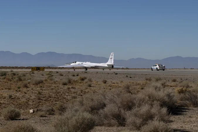
NASA's ER-2 Aircraft: The High-Flying Tool Unlocking Earth’s Secrets
2024-10-28
Author: Arjun
Introduction
NASA's ER-2 aircraft is not just an ordinary plane; it's the agency's highest-flying airborne science platform, soaring at altitudes above 99% of the Earth's atmosphere, reaching heights of up to 65,000 feet. This incredible ability allows the ER-2 to gather critical information about our planet's dynamics, especially through collaborative and multidisciplinary projects.
Diverse Environments
Kirk Knobelspiesse, an atmospheric scientist at NASA's Goddard Space Flight Center, highlights the diverse environments where these aerial missions take place, stating, "We're deploying instruments and people everywhere from dry lakebeds in the desert to coastal oceans." This extensive reach is essential as it helps scientists observe the ongoing changes our planet faces.
PACE-PAX Mission
One significant project utilizing the ER-2's capabilities is the Plankton, Aerosol, Cloud, ocean Ecosystem Postlaunch Airborne eXperiment (PACE-PAX). This mission is crucial for validating data collected from the recently launched PACE satellite, which went into orbit in February 2024. The PACE observatory is set to transform our understanding of the ocean, atmosphere, and land measurements, making it vital to ensure the accuracy of this newly acquired satellite data.
Significance of ER-2
"The ER-2 is the ideal platform for PACE-PAX because it's about the closest we can get to putting instruments in orbit without actually doing so," Knobelspiesse remarked, emphasizing the significance of the aircraft in supporting satellite missions.
Collaborative Efforts
The PACE-PAX mission is a collaborative effort, bringing together researchers from NASA, the National Oceanic and Atmospheric Administration (NOAA), the Netherlands Institute for Space Research (SRON), the University of Maryland, Baltimore County, the Naval Postgraduate School, and multiple other institutions. This teamwork is instrumental in harnessing collective expertise to tackle pressing global challenges related to climate change and environmental monitoring.
GEMx Project
Another noteworthy endeavor supported by the ER-2 is the Geological Earth Mapping eXperiment (GEMx), designed to examine critical mineral resources across the Western United States over several years. Kevin Reath, NASA's associate project manager for GEMx, explained, "Flying at this altitude means the GEMx mission can acquire wide swaths of data with every overflight." The ER-2 collects an impressive range of visible, shortwave infrared, and thermal infrared data, offering comprehensive insights into mineralogy.
Value of Data
The extensive dataset generated by GEMx is remarkable. "This is the largest airborne surface mineralogy dataset captured in a single NASA campaign," Reath noted. Such data is invaluable for federal, tribal, state, and community leaders as they make informed decisions regarding environmental protection and resource development.
Conclusion
With its groundbreaking capabilities and collaborative spirit, NASA's ER-2 aircraft is opening new windows into Earth's complex systems, providing insights necessary for action on pressing environmental issues. This extraordinary platform not only enhances our understanding of the world but also fosters global cooperation in the pursuit of a sustainable future.


 Brasil (PT)
 Canada (EN)
 Chile (ES)
 España (ES)
 France (FR)
 Hong Kong (EN)
 Italia (IT)
 日本 (JA)
 Magyarország (HU)
 Norge (NO)
 Polska (PL)
 Schweiz (DE)
 Singapore (EN)
 Sverige (SV)
 Suomi (FI)
 Türkiye (TR)