Harnessing Laser Technology to Combat Space Debris and Optimize Earth’s Water Resource Mapping
2024-10-31
Author: John Tan
Harnessing Laser Technology to Combat Space Debris and Optimize Earth’s Water Resource Mapping
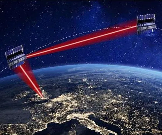
In a groundbreaking initiative, researchers at the Institute of Geodesy at TU Graz are leveraging advanced satellite laser ranging (SLR) technology to revolutionize how we track space debris and analyze Earth's gravitational variations, which are closely linked to our planet's water resources. This ambitious project, known as the COVER project, combines satellite gravity measurements with cutting-edge SLR methods, resulting in unprecedented accuracy in both gravitational mapping and orbital tracking.
Unlocking New Insights into Earth’s Gravity Field
The gravitational influence on satellites and the multitude of space debris orbiting Earth can provide vital insights into shifts in gravitational field variations, particularly those associated with water mass changes on the planet. Sandro Krauss, a leading researcher at TU Graz, emphasizes that while prior missions like Grace and GOCE have contributed significantly to our understanding of Earth's gravity, they often lack the resolution needed to capture long-wavelength gravitational components that can extend across continents.
In contrast, SLR technology is specifically designed to address this gap. This method employs a worldwide network of laser stations aimed at satellites outfitted with retro-reflectors, enabling measurements that achieve centimeter-level precision in pinpointing satellite locations. This level of detail allows researchers to notice even minute alterations in satellite orbits, which could indicate mass changes on the Earth’s surface, such as the melting of glaciers or shifts in groundwater reservoirs.
Enhancing Orbital Safety for a Crowded Space
The urgency of tracking space debris cannot be understated, as more than 40,000 objects larger than ten centimeters are currently orbiting Earth, alongside nearly one million fragments measuring one centimeter or more—all moving at a staggering speed of 30,000 km/h. Given the increasing risks of collision, especially with the rising number of satellites and crewed missions, accurate orbit prediction becomes crucial for ensuring the safety of all space operations.
Traditional radar systems, which are currently the gold standard in space debris tracking, typically offer location precision on the order of kilometers. This limitation presents challenges in accurately addressing the risk of costly collisions. However, the collaboration between TU Graz and the Austrian Academy of Sciences' Satellite Laser Ranging Station has resulted in significant advancements. By developing sophisticated force models that take into account the various forces acting upon satellites, researchers have achieved tracking precision within 100 meters.
From Groundbreaking Research to Open-Source Solutions
Torsten Mayer-Gurr, also from TU Graz, notes that in order to effectively predict satellite orbits, it is essential to consider all the forces acting on them, including gravitational influences from changing mass distributions like water. The integration of scientific models with SLR data empowers their GROOPS software, marking it as a leading open-source tool for gravity field, orbit determination, and SLR analysis. This software is not only pivotal in enhancing gravitational field resolution but is also continuously refined through user feedback.
In conclusion, the COVER project exemplifies the marriage of innovative technology and earth sciences, offering promising solutions to both enhancing our understanding of gravitational changes and improving the safety of our increasingly congested orbital pathways. With the ongoing collaboration in the scientific community, the future looks bright for both space exploration and more sustainable management of Earth’s vital water resources.


 Brasil (PT)
 Canada (EN)
 Chile (ES)
 España (ES)
 France (FR)
 Hong Kong (EN)
 Italia (IT)
 日本 (JA)
 Magyarország (HU)
 Norge (NO)
 Polska (PL)
 Schweiz (DE)
 Singapore (EN)
 Sverige (SV)
 Suomi (FI)
 Türkiye (TR)