Groundbreaking Joint Satellite Mission Reveals Alarming Effects of Climate Change on Greenland’s Ice Sheet
2024-12-23
Author: Mei
Introduction
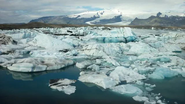
In a significant advancement for climate science, the European Space Agency (ESA) and NASA have captured their first collaborative images showcasing the rapid melting of Greenland's Ice Sheet, a phenomenon largely driven by global warming. These findings are essential, as rising sea levels and altered weather patterns threaten ecosystems and human populations worldwide.
Measurements and Collaboration
Recent analyses utilizing data from ESA's CryoSat-2 and NASA's ICESat-2 ice satellite missions have provided the first comprehensive measurements of the ongoing changes in Greenland's Ice Sheet thickness. This unprecedented collaboration combines the unique technological strengths of both satellites, with CryoSat-2 employing a radar system that can penetrate clouds, while ICESat-2 utilizes laser altimetry that provides accurate surface readings, albeit unable to function in cloudy conditions.
Study Findings
The complementary nature of these satellite missions has long been sought after by polar scientists, and a groundbreaking study from the Centre for Polar Observation and Modelling (CPOM) at Northumbria University illustrates their capabilities. The study indicates that measurements from both satellites align within a margin of 3%, confirming that combining their data produces a more accurate representation of ice loss than either satellite could provide individually.
Ice Sheet Thinning
Between 2010 and 2023, the Greenland Ice Sheet lost an average of 1.2 meters in thickness. More alarming are the dramatic changes observed in the ablation zone, where the thinning was recorded at over five times that rate, averaging 6.4 meters. The most extreme losses were seen at critical outlet glaciers, such as Sermeq Kujalleq (Jakobshavn Isbræ) and Zachariae Isstrøm, where thinning reached peaks of 67 and 75 meters, respectively.
Volume Loss
Over the 13-year span analyzed, Greenland’s Ice Sheet shrank by an astonishing 2,347 cubic kilometers—enough to fill Africa's Lake Victoria—notably accelerated during record hot summers in 2012 and 2019 when the ice loss exceeded 400 cubic kilometers annually. The implications of this massively increased ice melt are dire, affecting global ocean circulation and further disrupting atmospheric conditions.
Research Insights
Lead researcher Nitin Ravinder highlighted the excitement surrounding these findings, stating, 'The close agreement between CryoSat-2 and ICESat-2 measurements provides a strong incentive to unite our data sets, enhancing our estimates of ice sheet volume and mass changes.' The ramifications of ice sheet mass loss are particularly pressing, as they are crucial determinants of global sea level rise.
Cryo2ice Campaign
The study utilized data collected as part of the innovative Cryo2ice campaign, which kicked off a partnership between ESA and NASA in 2020. By synchronizing the orbits of CryoSat-2 and ICESat-2, researchers achieved nearly simultaneous collection of radar and laser data, significantly enhancing the accuracy of snow depth measurements.
Future Prospects
As Copernicus partners continue to bolster their capabilities, Tommaso Parrinello, CryoSat Mission Manager at ESA, remarked on the transformative potential of these ongoing partnerships: 'Aligning our missions not only improves precision but also aids scientists and policymakers who depend on our data for understanding climate change impacts.'
Collaboration Significance
Thorsten Markus, project scientist for NASA’s ICESat-2 mission, expressed optimism regarding this collaboration, emphasizing the value of understanding the differences and similarities between radar and lidar measurements for enriching the overall picture of Greenland’s changing ice cover.
Conclusion
The findings from this research will play a critical role in informing both scientists and policymakers, as CPOM continues to leverage satellite observations and numerical models to predict future changes in polar regions. In the face of unprecedented climate challenges, the data gleaned from these satellite missions will be vital in developing strategies to mitigate and adapt to the impacts of climate change on global sea levels.
Publication
The groundbreaking study, titled 'Greenland Ice Sheet Elevation Change From CryoSat-2 and ICESat-2,' has been published in the Geophysical Research Letters, solidifying its role in expanding our understanding of polar ice dynamics amidst the climate crisis.


 Brasil (PT)
 Canada (EN)
 Chile (ES)
 España (ES)
 France (FR)
 Hong Kong (EN)
 Italia (IT)
 日本 (JA)
 Magyarország (HU)
 Norge (NO)
 Polska (PL)
 Schweiz (DE)
 Singapore (EN)
 Sverige (SV)
 Suomi (FI)
 Türkiye (TR)