Earth from Space: The Battle Between Clouds and Snow Unveiled!
2024-11-15
Author: Yu
Introduction
In a fascinating showcase of satellite technology, the Copernicus Sentinel-2 mission has provided stunning images that help us discern between clouds and snow, revealing the incredible capabilities of modern Earth observation.
Copernicus Sentinel-2 Mission
Launched as part of the broader Copernicus program by the European Space Agency, the Sentinel-2 satellites are equipped with advanced high-resolution multispectral imagers that capture optical images across 13 different spectral bands, spanning from the visible to the shortwave-infrared regions of the electromagnetic spectrum. This powerful technology enables scientists and researchers to analyze our planet like never before.
Captivating Images from the Australian Alps
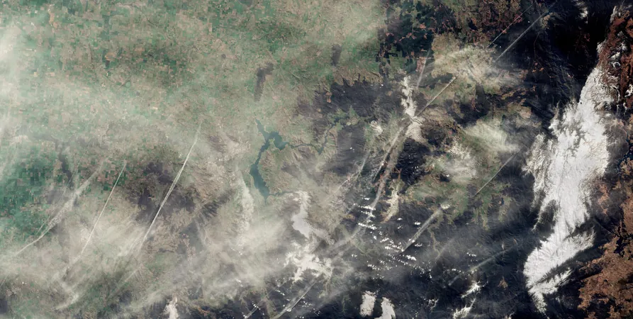
Recently, two captivating images from August 2024 captured the same area in the Australian Alps, showcasing a dramatic view of the landscape’s winter features. The left image presents a true-color representation, portraying the scene as the human eye perceives it. Here, we observe a snowy landscape blanketed by clouds, with noticeable contrails faded across the sky, likely originating from flights connecting bustling cities like Canberra and Melbourne.
Challenges in Interpretation
One of the most intriguing challenges in interpreting these images lies in the fact that both snow and clouds reflect visible light, resulting in a deceptive facade of whiteness. However, the right image employs shortwave-infrared bands, effectively differentiating the two elements. In this false-color image, pristine snow is rendered in vibrant electric blue, while water vapor, manifesting as clouds, remains depicted in stark white.
Visual Contrast and Insights
The contrasting visuals allow viewers to easily spot the snow in blue on the right, while the thicker clouds are painted in bright white towards the center. Lighter, more diffuse clouds and aircraft contrails fade into the background, demonstrating the sophistication of satellite imaging technology.
The Role of AI in Satellite Imagery
But the journey doesn't stop there! This capability is not just visually striking; it is crucial for the budding field of Artificial Intelligence (AI) in satellite image processing. The ongoing development in AI algorithms has led to significant advancements in accurately classifying and distinguishing between clouds and snow. By leveraging multispectral images from Sentinel-2, these algorithms are training to improve the precision of environmental assessments and weather predictions.
Conclusion and Future Exploration
As we delve deeper into environmental monitoring and earth sciences, satellite missions like Copernicus Sentinel-2 are becoming indispensable. They not only enhance our understanding of the Earth's processes but also contribute vital data to combat climate change and inform policy-makers.
Stay Tuned!
Stay tuned as we continue to explore the layers of our planet from above, revealing secrets hidden in the clouds and beneath the snow!


 Brasil (PT)
 Canada (EN)
 Chile (ES)
 España (ES)
 France (FR)
 Hong Kong (EN)
 Italia (IT)
 日本 (JA)
 Magyarország (HU)
 Norge (NO)
 Polska (PL)
 Schweiz (DE)
 Singapore (EN)
 Sverige (SV)
 Suomi (FI)
 Türkiye (TR)