Unraveling Mars' Great Dichotomy: A Journey of Erosion and Ancient Water
2025-01-20
Author: Ting
Gazing at the Dichotomy
The dichotomy, visually striking in relief maps crafted by NASA, showcases a dramatic elevation difference. The southern hemisphere, elevated by more than a kilometer, sits atop a substantial, thicker crust, while the northern hemisphere contrasts with its vast, low-lying basins. The equator generally marks the transition between these two regions, with some notable exceptions such as the volcanic Tharsis region.
Two unanswered questions linger over this dichotomy: how was it formed, and what role did it play in Mars’ early history? Theories range from early plate tectonics leading to geological upheavals to impacts from celestial bodies. Research suggests that Mars once hosted a warmer, wetter climate conducive to the development of significant water bodies, including the possibility of an ocean in its northern territories, sparking ongoing debates about the planet's hydrological history.
Diving Into Mawrth Vallis
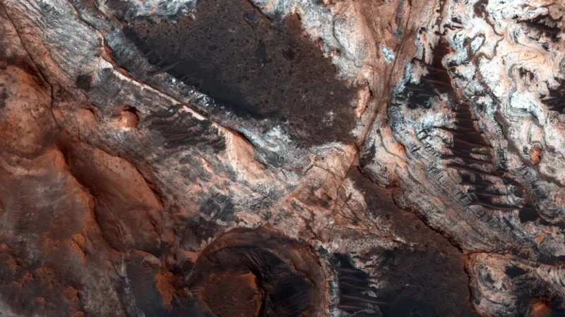
The study spotlights an area named Mawrth Vallis at the dichotomy's edge, characterized by a kilometer-high plateau that bears the scars of monumental flooding events evidenced by significant outflow channels. Surrounding this plateau are lowlands filled with distinctive buttes and mesas that rise up around a kilometer above the adjacent plains.
Utilizing data from the European Space Agency's Mars Express mission, the researchers analyzed these formations and found that they share similar elevation and mineral composition with the plateau. This led to a compelling conclusion: these formations are remnants of a once-mighty plateau now largely eroded away, extending over a vast area, hundreds of kilometers into the lowlands.
Water's Role in the Transformation
Crucially, the study indicates that the processes transforming the plateau were likely water-driven. The findings reveal a gradient in clay minerals—from magnesium-rich clays at deeper levels, indicative of interactions with volcanic materials in water, to aluminum- and iron-rich clays nearer the surface, possibly resulting from prolonged exposure to acidic water.
This erosion reflects a substantial geographical reformation, with estimations placing around 57,000 cubic kilometers of material lost in a mere 284,000 square kilometer area west of the notable Ares Vallis. As the researchers articulate, this massive removal hints at a vigorous water cycle that must have enveloped early Mars. Possible sources of water could have been an ocean as theorized or even melting from ice caps.
A Shoreline Mystery
The analysis adds layers of complexity to the concept of an ancient Martian ocean. Many mounds in the study region are positioned between two hypothesized shorelines of an ancient ocean, raising the possibility that their erosion could have been linked to the receding ocean itself. However, some features appear to be the result of the plain’s erosion rather than direct evidence of submerged landscapes.
While the new insights align with a vision of Mars abundant in water and subject to substantial erosion, they simultaneously indicate that the observed geological processes do not necessitate submersion under an ocean. Investigating the geological history of Mars reveals an intricate interplay between geological forces and water activity, making the possibility of a Martian ocean both tantalizingly close and frustratingly elusive.
As we continue to unearth the layered history of Mars, each discovery like this helps paint a broader picture of the red planet's potential for past life and our understanding of planetary evolution across the cosmos. The search for answers continues, drawing us deeper into Mars' enigmatic past.


 Brasil (PT)
 Canada (EN)
 Chile (ES)
 Česko (CS)
 대한민국 (KO)
 España (ES)
 France (FR)
 Hong Kong (EN)
 Italia (IT)
 日本 (JA)
 Magyarország (HU)
 Norge (NO)
 Polska (PL)
 Schweiz (DE)
 Singapore (EN)
 Sverige (SV)
 Suomi (FI)
 Türkiye (TR)
 الإمارات العربية المتحدة (AR)