Unveiling the NISAR Mission: A Revolutionary Leap in Earth Observation
2025-01-07
Author: Charlotte
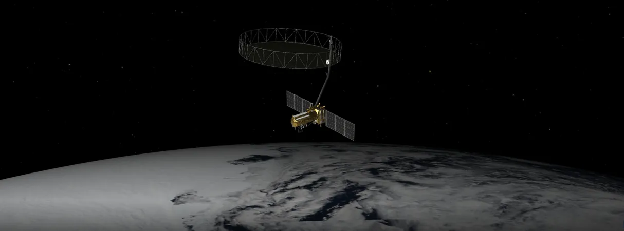
The imminent launch of the U.S.-India NISAR (NASA-ISRO Synthetic Aperture Radar) mission promises to transform our understanding of Earth's dynamic surface unlike any project before it. With a focus on monitoring environmental changes, NISAR stands to provide invaluable data for both scientific research and disaster management.
What makes the NISAR mission groundbreaking is its dual-band radar technology, making it the first of its kind. This advanced satellite will effectively measure land deformation caused by phenomena like earthquakes, landslides, and volcanic activity. It will also track the movements of glaciers and ice sheets, while continuously monitoring deforestation and wetland loss, thus offering critical insights into the globe's carbon cycle.
How NISAR Will Revolutionize Earth Monitoring
Earth’s landscapes are in constant flux, with changes occurring both subtly and dramatically. NISAR aims to capture these transformations on a weekly basis, with a resolution so fine that each pixel will represent an area roughly half the size of a tennis court. Such precision in observing nearly all land and ice surfaces will enable scientists to construct a comprehensive narrative about how our planet functions as a living system.
A Unique Technological Breakthrough
NISAR will uniquely combine two radar systems—an L-band radar with a 10-inch (25-centimeter) wavelength and an S-band radar with a 4-inch (10-centimeter) wavelength. The distinction in wavelengths allows NISAR to interact with various surface features in diverse ways. The shorter wavelength can detect smaller items like leaves and intricate textures, while the longer wavelength captures larger structures like boulders and trees. This dual approach will empower researchers to analyze a wider spectrum of environmental features, thus enhancing our overall understanding of Earth’s processes.
A Historical Perspective on SAR Technology
Although the concept of synthetic aperture radar (SAR) in space is not new, dating back to NASA's Seasat mission in the 1970s, NISAR represents a significant advancement. Seasat, despite its brief operational life, laid the groundwork for future innovations in satellite imaging and remote sensing. Paul Rosen, NISAR's project scientist at NASA's Jet Propulsion Laboratory, harkens back to how Seasat inspired a generation of scientists—himself included—to pursue careers in remote sensing.
Data Accessibility and Practical Applications
The data generated by the NISAR mission will cater to users across varied scientific domains, including ecosystems, the cryosphere, and geophysical sciences. Beyond academic research, the data will be instrumental in practical applications such as soil moisture assessment and water resource management. NASA has committed to making these massive datasets accessible via cloud storage, allowing researchers and the public to utilize this information freely.
The Partnership in Innovation
The collaboration between NASA and ISRO was born out of visionary planning initiated during the 2007 Decadal Survey by the National Academy of Sciences, which proposed an L-band satellite known as DESDynI. As ISRO sought to develop an S-band satellite, the two agencies merged their efforts to launch a dual-band mission. Over the years, hundreds of engineers worked together across more than 9,000 miles (14,500 kilometers) and 13 time zones, assembling the satellite in India—a testament to international scientific collaboration.
As the countdown to NISAR's launch begins, the scientific community and the world wait with bated breath for the insights that will emerge from this pioneering satellite mission. The unique capabilities of NISAR not only promise to enhance our understanding of Earth’s changing ecosystems but also provide critical tools for disaster response and management. The future of Earth observation is bright, and NISAR may just be its shining beacon.


 Brasil (PT)
 Canada (EN)
 Chile (ES)
 Česko (CS)
 대한민국 (KO)
 España (ES)
 France (FR)
 Hong Kong (EN)
 Italia (IT)
 日本 (JA)
 Magyarország (HU)
 Norge (NO)
 Polska (PL)
 Schweiz (DE)
 Singapore (EN)
 Sverige (SV)
 Suomi (FI)
 Türkiye (TR)
 الإمارات العربية المتحدة (AR)