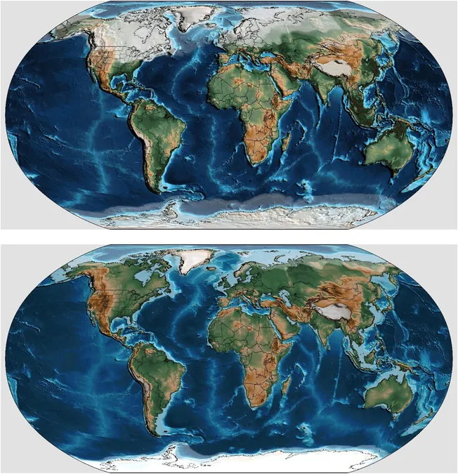
Unlocking 540 Million Years of Sea Level Secrets: What Scientists Just Discovered!
2025-07-07
Author: Noah
For as long as our planet has had water, sea levels have been shifting dramatically. While scientists have previously managed to map these changes over the span of millions of years through fossils and sediments, new groundbreaking research has allowed a detailed reconstruction of fluctuations in sea levels on a much finer scale: thousands of years.
In a remarkable study led by scientists from Utrecht University and partners in the UK and US, published on July 3 in *Earth and Planetary Science Letters*, the team has unveiled the intricate details of sea level changes over the last 540 million years—an unprecedented achievement in geological research.
Understanding Sea Level Dynamics!
Dr. Douwe van der Meer, a guest researcher at Utrecht University and the study's lead author, emphasizes the significance of these rapid variations. He states, "Understanding these fluctuations is crucial for comprehending subsurface structures and enhancing green energy resource applications."
The ebb and flow of sea levels hinge on two primary factors: tectonic activity, which shapes the ocean's depth, and the volume of land ice, which dictates the amount of water filling that space.
A Revolutionary Method: Geological Tree Rings!
Historically, scientists could only establish an average sea level with million-year timelines. However, this research introduces an innovative approach by treating geological formations like tree rings, analyzing sedimentary layers of sandstone and claystone from more recent epochs.
Interestingly, claystone indicates deep ocean conditions while sandstone signals shallower waters. The researchers discovered that during colder climates, sea levels could exhibit dramatic shifts of up to 100 meters within mere tens of thousands of years, correlating with ice ages driven by Earth’s axial shifts.
The Game-Changer: Short-Term Sea Level Variability!
By establishing relationships between Earth's historical climate and ice sheet sizes, the research team has successfully teased out short-term sea level variations going back 540 million years. Their findings align closely with fossil records, offering a clearer and more consistent perspective on sea level changes across different eras.
While remarkable ice age fluctuations of 100 meters were evident in the recent past, the Jurassic and Cretaceous periods saw more stable sea levels due to minimal land ice. In contrast, the late Carboniferous era—home to gigantic dragonflies—experienced significant sea level shifts, showcasing the effects of vast ice caps.
Transforming Underground Resource Management!
Armed with this newfound understanding of ancient sea levels, researchers can now produce more accurate geological maps that inform climate and evolutionary models. Dr. Van der Meer highlights the importance of this research for modern applications, stating, "We've seen high and low sea levels before, and those patterns help us today."
The implications stretch into various fields, from underground storage for CO2 and hydrogen to geothermal energy. Sandstone formations, which emerge during lower sea levels, can serve as reservoirs, whereas claystone layers created during high sea levels act as seals, preventing the passage of water or gases.
Moreover, as scientists search for sites to safely store radioactive waste, understanding past sea level highs can guide them toward continuous claystone layers, essential for ensuring safety in subsurface use.
This groundbreaking research not only enriches our understanding of geological history but also opens new avenues for sustainable resource management on our planet.


 Brasil (PT)
 Canada (EN)
 Chile (ES)
 Česko (CS)
 대한민국 (KO)
 España (ES)
 France (FR)
 Hong Kong (EN)
 Italia (IT)
 日本 (JA)
 Magyarország (HU)
 Norge (NO)
 Polska (PL)
 Schweiz (DE)
 Singapore (EN)
 Sverige (SV)
 Suomi (FI)
 Türkiye (TR)
 الإمارات العربية المتحدة (AR)