Hidden Treasures: The Life Beneath the Great Salt Lake's Shrinking Surface
2025-09-02
Author: Jacques
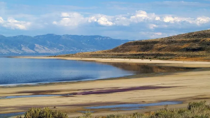
From Sea to Desert: The Great Salt Lake's Transformation
Once a colossal body of water measuring up to 1,000 feet deep and covering approximately 20,000 square miles, the Great Salt Lake has morphed into a desolate landscape. Yet, as the waters retreat, life is emerging where once there was only desolation, leaving scientists both intrigued and puzzled.
The Mystery of the Green Mounds
Unexpectedly, reed-covered mounds have begun sprouting along the lake’s southeastern shore, acting as lush hideaways amidst the arid surroundings. These verdant patches indicate an unseen source of fresh water, but where is it coming from? Researchers from the University of Utah are on a mission to solve this enigma, revealing a subsurface network that channels fresh groundwater into the lake and its adjacent wetlands.
A Resource for the Future?
Co-researcher William Johnson, a geology professor at the University of Utah, warns of the need to understand this resource better before it is mismanaged. As he succinctly put it, "This could be a valuable water source moving forward, but we must ensure it’s not overexploited to the detriment of the wetlands."
Facing an Environmental Crisis
The Great Salt Lake's decline has been exacerbated by human activities, including the diversion of freshwater from its tributaries for agriculture and drinking water. Compounded by climate change, the region's increasing evaporation rates have caused severe water shortages, stressing the lake’s tributaries and accelerating its decline.
The Potential Solution Beneath Our Feet
The undetected freshwater beneath the lakebed presents a potential lifeline, capable of replenishing the lakebed’s crust and mitigating harmful dust pollution affecting nearby communities. In pursuit of this solution, Johnson and his team are employing advanced tools—piezometers, seepage meters, and salinity profiles—to uncover underground water supplies.
Revolutionizing Research: Advanced Technology at Work
In February, they enlisted the expertise of Canadian firm Expert Geophysics to execute aerial electromagnetic surveys above Farmington Bay. This involved using a helicopter equipped with sensors to map the subsurface landscape. The data collected from these surveys will allow researchers to create a 3D model of the underground water reserves.
The Hidden Aquifer: A Slow Rise to the Surface
The research thus far suggests that a substantial reservoir of freshwater lies thousands of feet beneath the lakebed. Johnson theorizes that the immense pressure on this aquifer permits water to gradually seep through the sediment, resulting in the formation of those mysterious green mounds where fresh groundwater makes its slow ascent to the surface.


 Brasil (PT)
 Canada (EN)
 Chile (ES)
 Česko (CS)
 대한민국 (KO)
 España (ES)
 France (FR)
 Hong Kong (EN)
 Italia (IT)
 日本 (JA)
 Magyarország (HU)
 Norge (NO)
 Polska (PL)
 Schweiz (DE)
 Singapore (EN)
 Sverige (SV)
 Suomi (FI)
 Türkiye (TR)
 الإمارات العربية المتحدة (AR)