Brace for 20 cm of Snow in Ontario Cities! Hazardous Travel Conditions Ahead!
2025-01-08
Author: Benjamin
Hazardous Travel Conditions in Southern Ontario
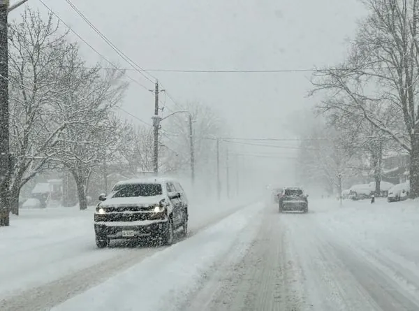
Residents of Southern Ontario should prepare for rapidly changing and potentially dangerous travel conditions as a series of snow squalls sweep across the region, particularly affecting areas around Lake Huron and Georgian Bay. The situation has led to multiple road closures and ongoing snow squall warnings.
Weather Warnings and Expected Snowfall
According to Environment and Climate Change Canada (ECCC), visibility may be severely reduced in certain locations, making driving treacherous. "Travel is expected to be hazardous due to reduced visibility in some locations. Rapidly accumulating snow could make travel difficult over some areas," ECCC warned for the London area, which has already seen up to 25 cm of snowfall as of Wednesday morning. Additional snowfall of 5-15 cm is expected throughout the day.
Snow Squall Warnings Across Ontario
Residents in Barrie, Collingwood, and other nearby towns are also under similar warnings, highlighting the breadth of the severe weather affecting the traditional snowbelt regions. If the snow squalls linger over a specific area, some locations could see even heavier accumulations.
Impact of Winds and Future Snowfall Forecasts
Northwesterly winds gusting at 20-40 km/h will add to the frigid conditions, with snow squalls forecasted to taper off by Thursday morning as the winds begin to shift. However, an approaching weather system could bring light snow back into the forecast for Friday into Saturday, stemming from moisture tracking northward from a storm venturing across the southern United States.
Weekend and Long-Term Weather Outlook
As we head into the weekend, temperatures are expected to recover to near-normal levels, but bands of lake-effect snow will likely continue to impact areas southeast of Lake Huron and Georgian Bay. Snow activity is projected to persist into next week, particularly affecting the same regions.
Looking Ahead: January Weather Patterns
Despite the relatively calm forecast for the immediate future, meteorologists warn that the second half of January may bring a more active weather pattern, raising the possibility of significant snowfall as systems from Colorado and Texas could tap into moist air from the Gulf of Mexico.
Travel Advice for Residents
In the meantime, as temperatures dip below seasonal averages this upcoming third week of January, residents are advised to stay informed and plan their travel carefully. With winter in full swing, the best advice remains: stay safe and be prepared for winter's unpredictable fury.
Stay Informed and Safe!
Don't miss out on crucial weather updates—stay tuned and stay safe!


 Brasil (PT)
 Canada (EN)
 Chile (ES)
 Česko (CS)
 대한민국 (KO)
 España (ES)
 France (FR)
 Hong Kong (EN)
 Italia (IT)
 日本 (JA)
 Magyarország (HU)
 Norge (NO)
 Polska (PL)
 Schweiz (DE)
 Singapore (EN)
 Sverige (SV)
 Suomi (FI)
 Türkiye (TR)
 الإمارات العربية المتحدة (AR)